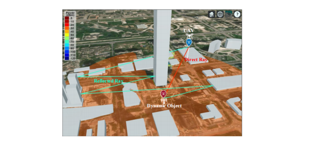
The Ray-Tracing propagation model.
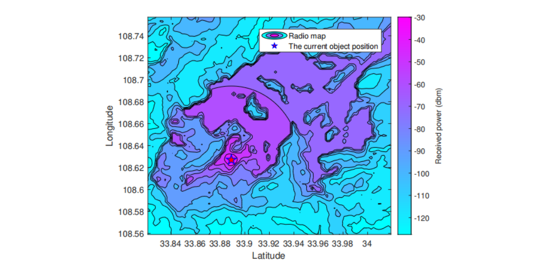
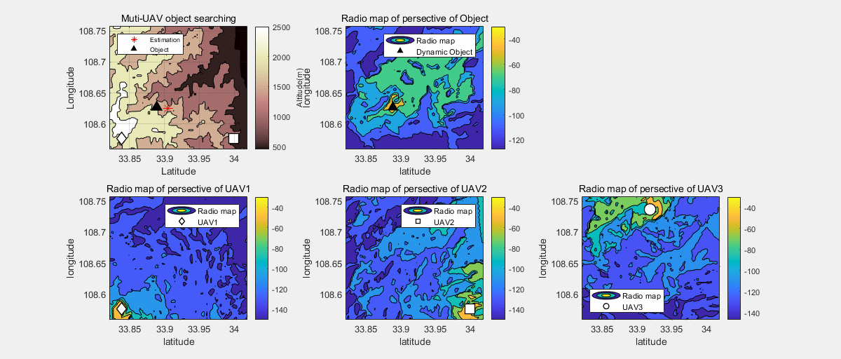
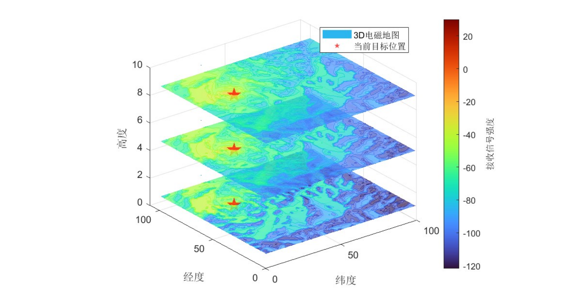
Radio map
Northwest University
The Radio Environment Map (REM), also known as an electromagnetic map, is a technology that combines electromagnetic environment data with geographic information to offer a visualized and quantitative description of the electromagnetic spectrum. This capability allows for better understanding and management of complex electromagnetic environments. As a crucial tool for characterizing and visualizing electromagnetic spaces, REM has emerged as an essential asset in what is considered the sixth domain of operations—alongside land, sea, air, space, and cyberspace. It plays a pivotal role in applications such as spectrum interference coordination and mitigation, dynamic spectrum access, cognitive radio network operations, and radio localization, serving as a vital technology for future integrated operations.
By incorporating sensor data, prior knowledge, and advanced spatial interpolation techniques, REM can accurately depict the types, properties, and distributions of electromagnetic signals. This functionality offers valuable decision-making support in key areas such as electromagnetic pollution prevention, spectrum management, and dynamic spectrum access.